Get worlwide climate data for free from NASA in 3 steps ?
This tutorial helps you to get free set of meteorological data from NASA database through the POWER DATA ACCESS VIEWER online free tool.
Particularly you will learn how to get radiation values on horizontal and tilted surface.
Get radiation values on tilted or horizontal surface anywhere in the world :
STEP 1 :
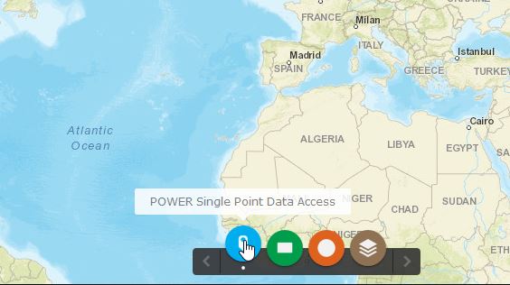
First you have to connect to the NASA Surface meteorology and Solar Energy database for a particular location, here :
Power Data access Viewer : NASA solar radiation and meteorological data
Select the "Power single point solar access" for data for a specific point on the map.
STEP 2 :
Keep the default "SSE-Renewable energy" selection.
Choose a temporal average :
- dayly
- interranual (to get monthly average radiation for choosen years )
- climatology (to get an average of monthly and annual data on a period of 22 years)
with the "point" button, select a location on the map. (example for London).
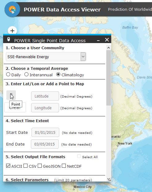
Select Output File Formats (CSV for excel worksheet).
Select meteorological parameters for which you want to get dayly or monthly values. To get irradiance on tilted solar panels select : tilted solar panels/Solar irradiance for equator facing tilted surfaces.
See here :
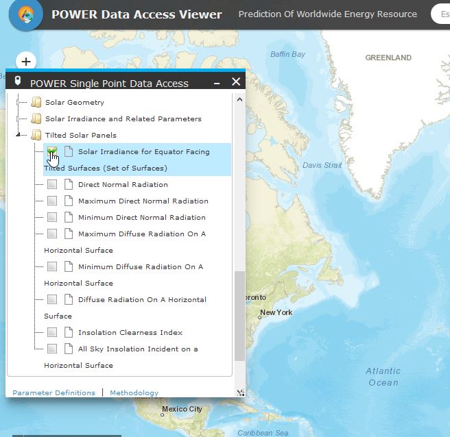
Then clic on the submit button.
STEP 3 : RESULT :
You will get a link to CSV files that can be opened with Excel.
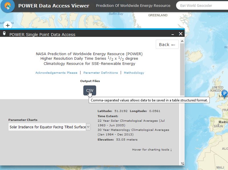
You can get an example of files here : example of meteorological file from NASA Power Data Access Viewer application
In this file you get the monthly and annual average irradiance values for the following parameters in kwh/day.m² :
SI_EF_TILTED_SURFACE_0 : irradiance on horizontal surface
SI_EF_TILTED_SURFACE_36 : irradiance on tilted solar panels with slope 36°
SI_EF_TILTED_SURFACE_51 : irradiance on tilted solar panels with slope 51°
SI_EF_TILTED_SURFACE_66 : irradiance on tilted solar panels with slope 66°
SI_EF_TILTED_SURFACE_90 : irradiance on tilted solar panels with vertical slope 90°
SI_EF_OPTIMAL : irradiance on tilted solar panels with optimal angle for max annual production
SI_EF_OPTIMAL_ANG : optimal angle according to month
SI_EF_TILTED_ANG_ORT : orientation of solar panels (position of the equator according to solar panels)
To get the annual sum of radiation you have to take the annual average (kwh/m2/day) and multiply it by 365 (days).
For our example (London) the annual horizontal global solar radiation is 2.79*365=1018 kWh/m2 per year.
Get average monthly and annual temperature, wind, insolation and precipitation data anywhere on the globe :
Just follow the same methodology as above and select the relevant parameters :
- Meteorology (Temperature) : Air temperature at 2 m
- Meteorology (Other) : precipitation
- Meteorology (Wind) : wind speed at 10 m
You will get monthly and annual average values per day, just multiply per 365 to get the total amount per year.
Note that one degree of latitude represents a distance about 110 km on earth, same thing for the longitude, as the meteo dataset is given for half a degree, the area covered is about a square of 4225 km2.
This is not so big for a first assessment of energy production, specially for area without mountains.
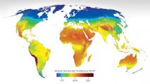
With the POWER DATA ACCESS VIEWER you can also get worlwide meteorological parameter interactive maps.
An example with the insolation world map :
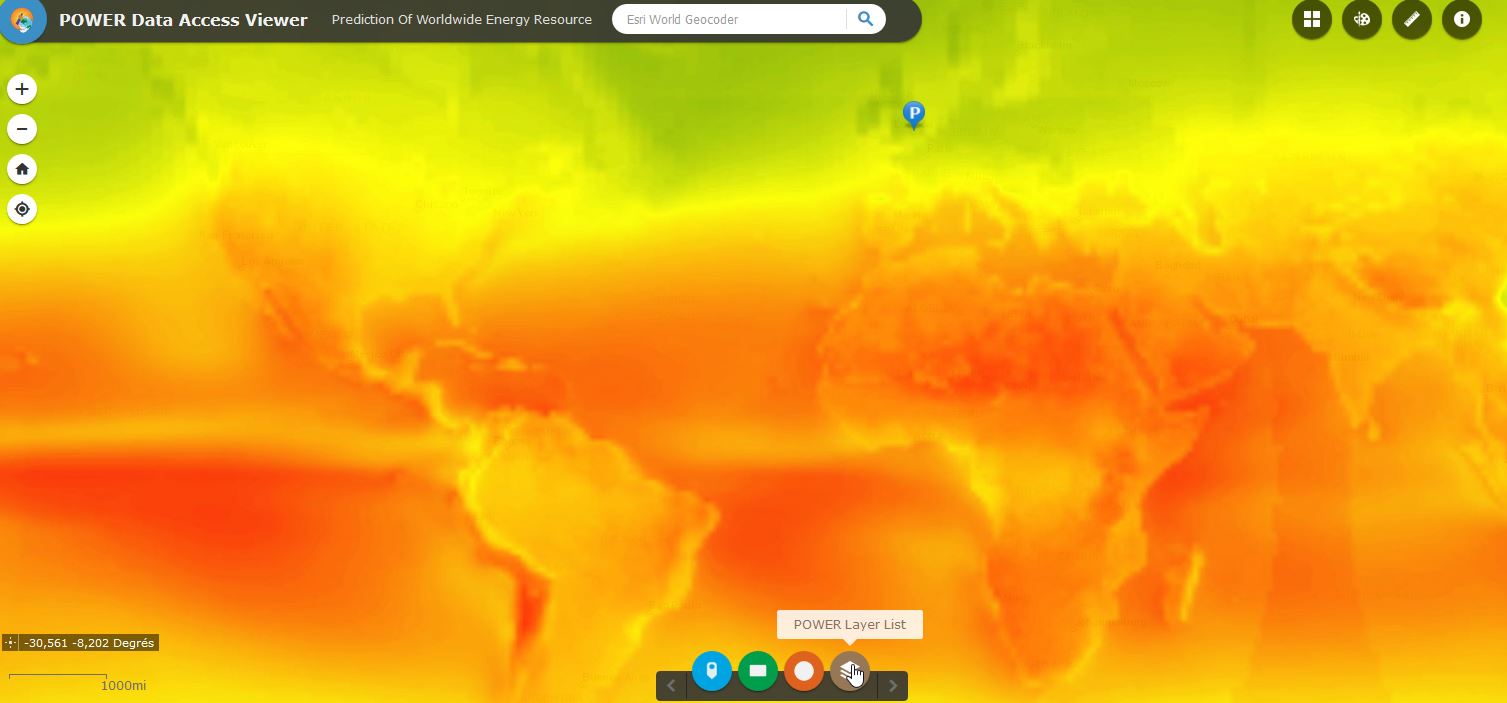
To get a complete list of solar radiation, check the Solar radiation databases.
- Details

